
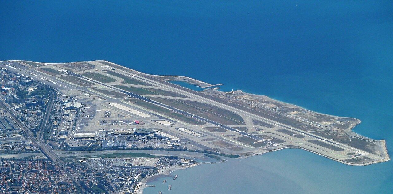

Runways
| Runway | Length | Width | Surface |
|---|---|---|---|
| 04R/22L 45° / 225° true |
9,721 ft2,963 m | 148 ft45 m | asphalt · lit |
| 04L/22R 45° / 225° true |
8,622 ft2,628 m | 148 ft45 m | asphalt · lit |
Runway numbers are the magnetic heading divided by ten, rounded; L, C and R mark parallel runways. Displaced thresholds shorten the usable length at some ends.
Location and time
| Coordinates | 43.7°N, 7.2°E (43.6584, 7.2159) |
|---|---|
| Region | Provence-Alpes-Côte-d'Azur, France |
| Time zone | Europe/Paris: UTC+1 standard time, UTC+2 during daylight saving time |
| Official site | www.nice.aeroport.fr/en |
Distances and flight times to world hubs
| Hub | Distance | From NCE | To NCE |
|---|---|---|---|
| Paris CDG | 694 km431 mi | 1 h 55 min | 1 h 50 min |
| Frankfurt FRA | 715 km445 mi | 1 h 50 min | 1 h 55 min |
| London LHR | 1,041 km647 mi | 2 h 20 min | 2 h 10 min |
| Istanbul IST | 1,780 km1,106 mi | 2 h 55 min | 3 h 20 min |
| Doha DOH | 4,486 km2,787 mi | 5 h 45 min | 6 h 40 min |
| Dubai DXB | 4,785 km2,973 mi | 6 h 05 min | 7 h |
| Delhi DEL | 6,308 km3,920 mi | 7 h 35 min | 9 h |
| New York JFK | 6,407 km3,981 mi | 9 h 05 min | 7 h 40 min |
| Toronto YYZ | 6,631 km4,120 mi | 9 h 20 min | 8 h |
| Chicago ORD | 7,290 km4,530 mi | 10 h 05 min | 8 h 40 min |
| Atlanta ATL | 7,626 km4,739 mi | 10 h 35 min | 9 h |
| Johannesburg JNB | 8,053 km5,004 mi | 10 h 05 min | 10 h 20 min |
| Beijing PEK | 8,327 km5,174 mi | 9 h 50 min | 11 h 15 min |
| São Paulo GRU | 9,250 km5,748 mi | 11 h 55 min | 11 h 15 min |
| Hong Kong HKG | 9,563 km5,942 mi | 11 h 05 min | 12 h 55 min |
| Mexico City MEX | 9,763 km6,066 mi | 13 h 10 min | 11 h 15 min |
| Los Angeles LAX | 9,779 km6,076 mi | 12 h 55 min | 11 h 30 min |
| Tokyo HND | 9,987 km6,206 mi | 11 h 50 min | 13 h |
| Singapore SIN | 10,448 km6,492 mi | 12 h 10 min | 13 h 45 min |
| Sydney SYD | 16,741 km10,402 mi | 19 h 05 min | 21 h 10 min |
Estimated scheduled flight times for a nonstop flight; whether one operates is not something we track. Linked hubs have a full route page.
Nearest airports with scheduled flights
| Airport | Distance |
|---|---|
| Levaldigi CUF Cuneo International Airport · Italy | 104 km65 mi NNE |
| Hyères, Var TLN Toulon-Hyères Airport | 107 km66 mi SW |
| Genova GOA Genoa Cristoforo Colombo Airport · Italy | 155 km96 mi ENE |
| Marignane MRS Marseille Provence Airport | 163 km101 mi W |
| Caselle Torinese TRN Turin Airport · Italy | 175 km109 mi N |
| Calvi CLY Calvi Sainte Catherine Airport | 179 km111 mi SE |
| Avignon AVN Avignon Caumont airport | 188 km117 mi W |
| Bastia BIA Bastia-Poretta International airport | 221 km138 mi ESE |
How far can you get?
Of the 265 airports with guides on this site, roughly this many are within a nonstop flight of:
513 hours
846 hours
1069 hours
21512 hours
Explore everything within X hours of NCE
Route guides from NCE
Radio frequencies
| Service | Description | MHz |
|---|---|---|
| Approach/departure | NICE APP | 124.175 |
| ATIS (recorded airport information) | NICE ATIS | 129.600 |
| Ground | NICE GND | 121.775 |
| Tower | NICE TWR | 118.700 |
From OurAirports’ community-maintained list. Frequencies change; check the current official publication. Not for navigation.
Checking a different trip? Use the flight-time calculator. Not covered: airlines, schedules, fares, terminals and live departures.