
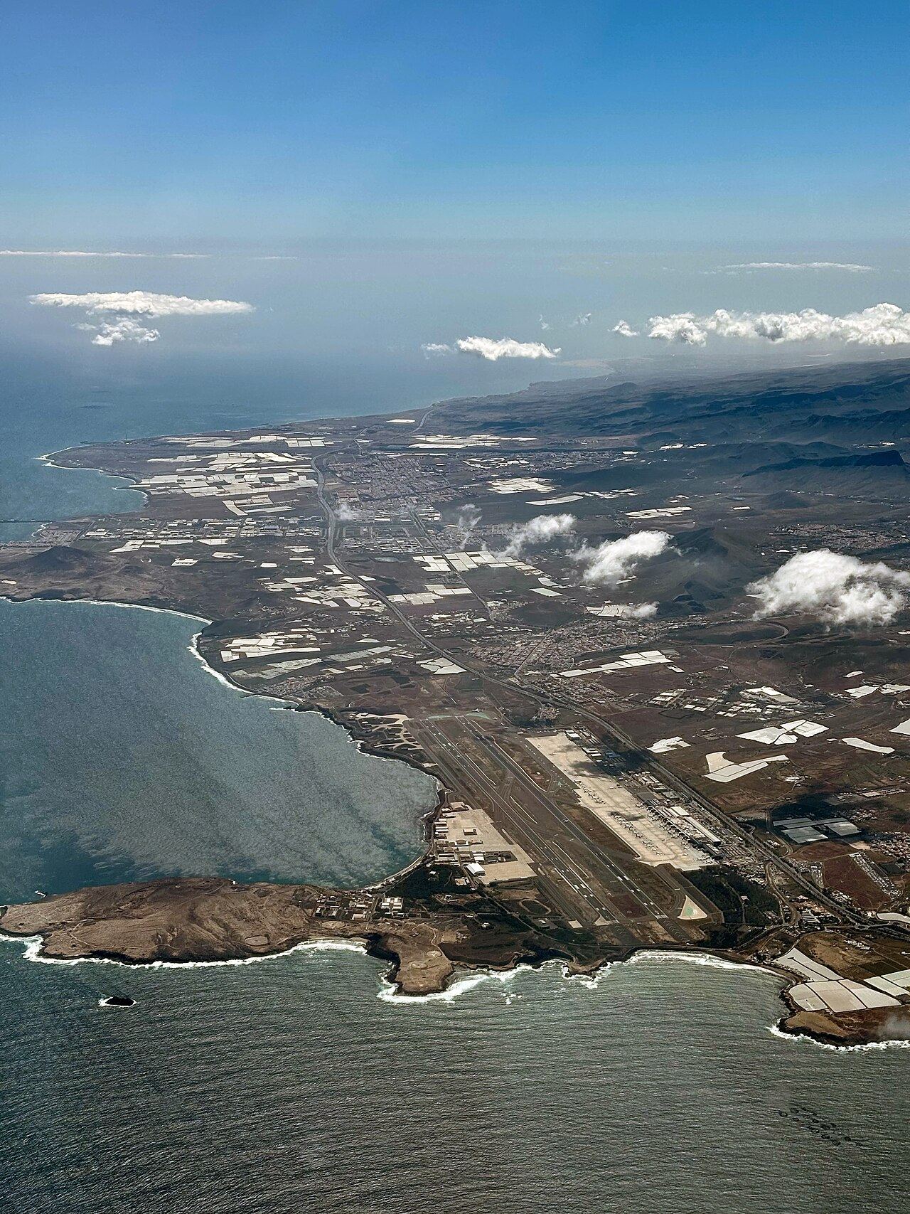

Runways
| Runway | Length | Width | Surface |
|---|---|---|---|
| 03L/21R 22° / 202° true |
10,171 ft3,100 m | 148 ft45 m | asphalt · lit |
| 03R/21L 22° / 202° true |
10,171 ft3,100 m | 148 ft45 m | asphalt · lit |
Runway numbers are the magnetic heading divided by ten, rounded; L, C and R mark parallel runways. Displaced thresholds shorten the usable length at some ends.
Location and time
| Coordinates | 27.9°N, 15.4°W (27.9319, -15.3866) |
|---|---|
| Region | Canary Islands, Spain |
| Time zone | Atlantic/Canary: UTC+0 standard time, UTC+1 during daylight saving time |
| Official site | www.aena.es/en/gran-canaria.html |
Distances and flight times to world hubs
| Hub | Distance | From LPA | To LPA |
|---|---|---|---|
| Paris CDG | 2,801 km1,740 mi | 4 h 05 min | 4 h 25 min |
| London LHR | 2,899 km1,802 mi | 4 h 15 min | 4 h 30 min |
| Frankfurt FRA | 3,184 km1,978 mi | 4 h 25 min | 4 h 55 min |
| Istanbul IST | 4,249 km2,640 mi | 5 h 30 min | 6 h 25 min |
| New York JFK | 5,445 km3,384 mi | 7 h 55 min | 6 h 40 min |
| Toronto YYZ | 5,899 km3,665 mi | 8 h 30 min | 7 h 10 min |
| Atlanta ATL | 6,504 km4,042 mi | 9 h 15 min | 7 h 50 min |
| Doha DOH | 6,581 km4,089 mi | 7 h 55 min | 9 h 10 min |
| Chicago ORD | 6,593 km4,097 mi | 9 h 20 min | 7 h 50 min |
| São Paulo GRU | 6,613 km4,109 mi | 8 h 40 min | 8 h 25 min |
| Dubai DXB | 6,940 km4,312 mi | 8 h 20 min | 9 h 40 min |
| Johannesburg JNB | 7,609 km4,728 mi | 9 h 30 min | 9 h 50 min |
| Mexico City MEX | 8,414 km5,228 mi | 11 h 25 min | 9 h 55 min |
| Delhi DEL | 8,788 km5,460 mi | 10 h 10 min | 12 h 05 min |
| Los Angeles LAX | 9,392 km5,836 mi | 12 h 50 min | 10 h 45 min |
| Beijing PEK | 10,971 km6,817 mi | 12 h 45 min | 14 h 25 min |
| Hong Kong HKG | 12,217 km7,591 mi | 13 h 50 min | 16 h 15 min |
| Tokyo HND | 12,491 km7,762 mi | 14 h 45 min | 15 h 45 min |
| Singapore SIN | 12,785 km7,944 mi | 14 h 45 min | 16 h 30 min |
| Sydney SYD | 18,571 km11,540 mi | 21 h | 23 h 30 min |
Estimated scheduled flight times for a nonstop flight; whether one operates is not something we track. Linked hubs have a full route page.
Nearest airports with scheduled flights
| Airport | Distance |
|---|---|
| Tenerife TFN Tenerife Norte-Ciudad de La Laguna Airport | 112 km70 mi WNW |
| Tenerife TFS Tenerife Sur Airport | 117 km73 mi W |
| El Matorral FUE Fuerteventura Airport | 160 km99 mi ENE |
| Lanzarote ACE César Manrique-Lanzarote Airport | 207 km129 mi ENE |
| El Aaiún EUN Laayoune Hassan I International Airport · Western Sahara (disputed territory) | 230 km143 mi ESE |
| Sta Cruz de la Palma SPC La Palma Airport | 244 km152 mi WNW |
| El Hierro Island VDE El Hierro Airport | 246 km153 mi W |
| Smara SMW Smara Airport · Western Sahara (disputed territory) | 389 km242 mi ESE |
How far can you get?
Of the 265 airports with guides on this site, roughly this many are within a nonstop flight of:
83 hours
666 hours
1309 hours
17512 hours
Explore everything within X hours of LPA
Route guides from LPA
Radio frequencies
| Service | Description | MHz |
|---|---|---|
| Approach | APP | 120.900 |
| ATIS (recorded airport information) | ATIS | 118.600 |
| Ground | GND | 121.700 |
| Tower | TWR | 118.300 |
From OurAirports’ community-maintained list. Frequencies change; check the current official publication. Not for navigation.
Checking a different trip? Use the flight-time calculator. Not covered: airlines, schedules, fares, terminals and live departures.